WA Thunderstorms Bringing Big Fire Danger & 30 Degree Temp Change
Enjoy the heat today because a change in the hot weather is coming fast and bringing possible large fire danger with it.


Huge Temp Changes Predicted for Parts of Washington State
If you live east of the Cascade Mountains, this summer has been pretty hot and dry. That hot weather a large portion of Washington State has gotten used to is about to change quickly. A 30° change in temperature is expected caused by a large storm front that is blowing in early Tuesday. That storm is bringing windy & dry conditions that could mean an increase in danger for wildfires. The high for today (Monday 8/28/23) in the Tri-Cities is expected to be around 96° and the high for Spokane is forecast to be 93°. By Thursday, both areas are expecting highs of just 66° and a change of 30 degrees in just a few days.

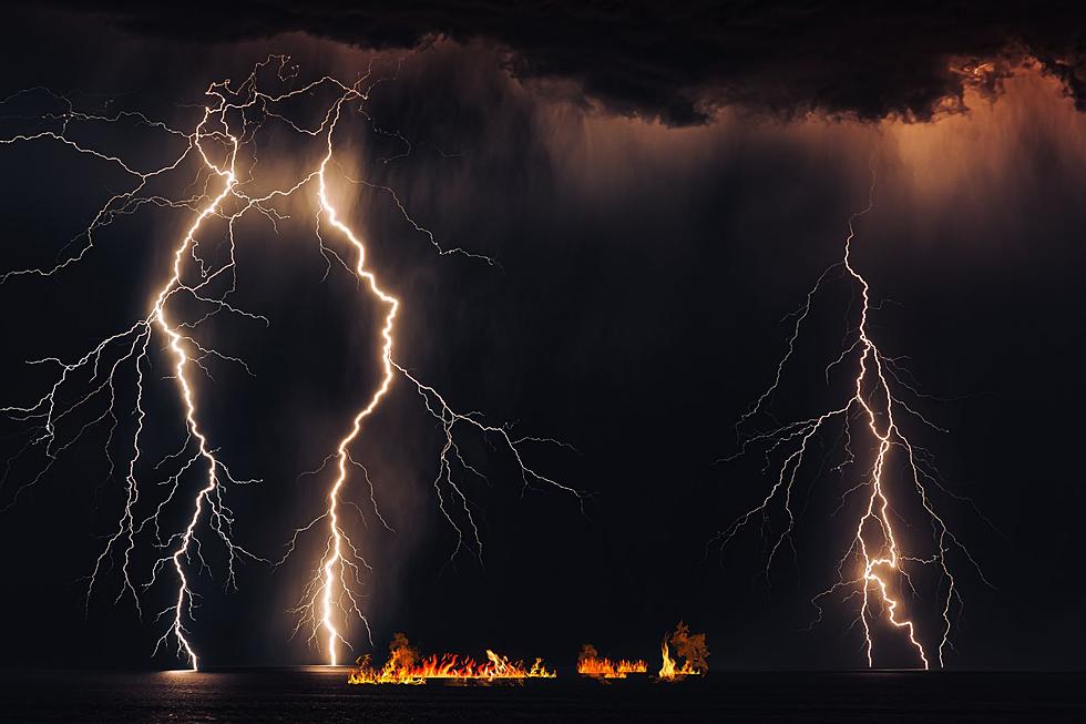
Washington State Fire Danger: Lighting & Wind + Dry Conditions
Even though the temperatures will drop drastically, not a lot of moisture is expected. The long stretch of hot weather that has dried out most of Washington State and the storm blowing in could make the fire danger very high. After a hot dry summer, residents need to be aware of the dangers and be smart. Lighting is forecast for most of Washington State east of the Cascades starting Tuesday with 40 mph wind gusts. Also, Wednesday's storms are only expected to bring less than 1/10th an inch of rain, putting all the dry foliage in danger of sparking wildfires with the lightning and wind also expected. Wednesday will also bring no rain but wind gusts forecast around 45 mph. Any fires sparked during this time could be very dangerous and spread quickly, so please take extra caution. Hopefully, some more rain will fall on Friday to help these extra dry conditions.
12 Washington State Extreme Weather Records
Gallery Credit: AJ Brewster
8 Important Washington State Back-to-School Safety Tips
Gallery Credit: AJ Brewster
More From 97.1 KXRX


